Tornado confirmed in South Carolina from Monday’s storms

The National Weather Service issued a tornado warning for that area at 8:49 p.m. Monday.
COLUMBIA, S.C. — The National Weather Service confirms a tornado formed in Chapin along Lake Murray during Monday night’s severe weather.
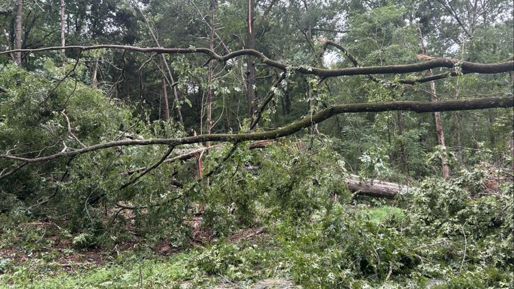
Survey teams went up to Chapin Tuesday morning and confirmed that a twister struck near the Lake Tide Drive area on the northern side of the lake. The weather service later said the storm was an EF-1, which is the second lowest rating on the Enhanced Fujita Scale, which measures a tornado’s strength. It’s estimated the storm had peaks winds of 95 miles an hour.
According to the survey team, the twister was about 200 yards wide and traveled a 6.17 mile long path. It existed for about six minutes total beginning at 8:43 p.m.
A map of the track shows the tornado formed on the lake and then moved onto Highwater Court. It then traveled a east-northeast path where it crossed Amicks Ferry Road. It was at peak intensity when it crossed Lake Tide Drive, went back briefly over water twice as it crossed Sandbar Road, then went back on land. It crossed Odld bush River Road and passed just north of Chapin Elementary School. It went over Highway 76 before finally dissipating near Old Lauren Lane.
The National Weather Service issued a tornado warning for that area as a wave of powerful storms moved through the area. Multiple people posted pictures and videos taken in that time frame that showed impressive looking clouds near Lake Murray.
The storms began picking up in intensity around 7:30 p.m., first moving into Saluda and Newberry Counties. They then began entering the central Midlands a little after 8 p.m.
There were reports of some trees down and damaged power lines. Lexington County had the most outages, with over 3,000 at the peak of the storm.


